Evrytania - Central Greece (Greece)
Evrytania. Prefecture Evrytania is considered an ideal destination for a holiday in all seasons; it is a mountainous area of breath-taking natural beauty. District Evrytania is a true wonder of nature and has very picturesque scenery, mountains with forests, deep valleys, rivers, waterfalls, gorges. Beauty is everywhere. It is densely wooded and one of the water richest areas of Greece. It is often called the "Switzerland" of Greece. It’s a highly recommended spot for travellers seeking natural life.
Evrytania, the most mountainous prefecture of Greece, is popular in the winter because of its ski resorts. When you come here in the winter, you’ll be surprised of the gorgeous snow-white countryside.
Karpenissi is the capital of the prefecture and is situated at the foot of Mount Timfristos at an altitude of 960 meters (3149 feet). The clear atmosphere, the dry healthy climate, and the sycamore, chestnut and pine trees make Karpenissi an ideal summer or winter vacation destination.
Photo Gallery Central Greece - Photos of Central Greece
more photos of Central Greece»
Sights and tips Evrytania
- Timfristos mountain (2,315 meters/7,005 feet), Kaliakoudas (2,101 meters/6,896 feet), Chelidonas (1,975 meters/6,480 feet).
- The rivers Krikelopotamos, Trikeriotis, Tavropos and Lake Kremasti. The area is ideal for walkers and mountaineers who can combine skiing, kayaking and rafting.
- The village Tripotamo on the eastern shore of Lake Kremasti. The name of the village was formerly Tatarna, which is also the name of the bridge that connects the prefectures Aetoloakarnania with Evrytania. This bridge is one of the longest bridges in the Balkans.
- The historic Monastery of the Holy Mother Faneromeni in Tripotamo.
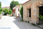
- Beautiful villages in the forested mountains.
- Ruins of the church Agios Leonidas in the village Klapsi.
- The Karpenissi ski center located on Mount Velouchi at an altitude of 1,840 meters (6,037 feet). It has 11 ski slopes at an altitude ranging from 1,800 meters to 2,220 meters (5,906 to 7,283 feet).
- The traditional villages Gorgianades, Korischades, Klafsi, Voutiro, Nostimo, Fidakia and Kalesmeno.
Text: Yorgos and Wendy Nikolidakis - Revised by Katrina Butzer
Weather forecast Evrytania
Evrytania in other languages
 Evritania (GriekseGids.nl)
 Evritania (GriekseGids.be)
 Evrytania (GreeceGuide.co.uk)
 Evritania (GriechenlandWeb.de)
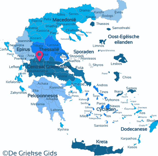
Evrytania: Where on the map is Evrytania located?
